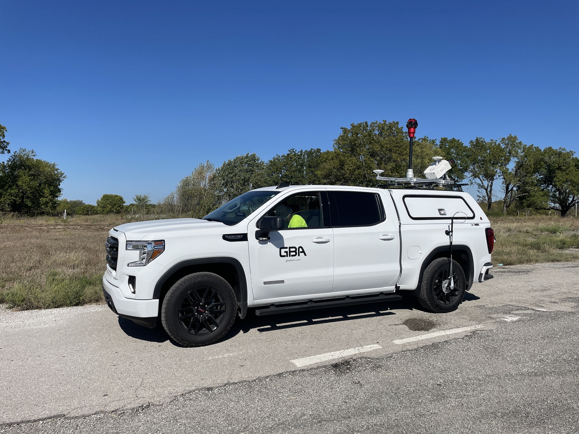
The Benefits of Mobile LiDAR for Surveying
Over the course of the past 50+ years that GBA has been in business, we have seen many changes in the technology used in surveying and engineering. These changes typically make great strides to make our jobs easier, more efficient, more cost-effective, and safer. One of our more recent changes that has come to GBA is Mobile LiDAR.
What is Mobile LiDAR?
Mobile LiDAR (Light Detection and Ranging) is a surveying technology that uses survey-grade GPS and laser scanners mounted on vehicles to capture accurate and high-resolution 3D data of the surrounding environment.

What are the Benefits of Using LiDAR?
As a tool for surveying and engineering, LiDAR has several benefits for a variety of projects. Here are some benefits GBA has found using mobile LiDAR in land surveying:
Increased Efficiency:
Mobile LiDAR systems capture data at high speeds, allowing for the efficient mapping of large areas. Because of this, long stretches of roadways, parking areas, or streetscapes are scanned quickly and accurately. This allows GBA surveyors to collect data in a fraction of the time compared to traditional surveying methods. An example of this benefit is shown in our recent project: GBA’s LiDAR Surveying: 1500 Signs Completed Ahead of Schedule
Versatility:
Mobile LiDAR can be used in a variety of settings, including urban environments, long stretches of roadways, parking areas, streetscapes, and forests. It can also be utilized to survey structures such as bridges, buildings, and tunnels.
More Accurate and Complete Data:
Mobile LiDAR captures data with sub-centimeter accuracy, providing more precise information for design and analysis. Additionally, LiDAR reduces the need for repeat trips to a project site when additional scope is required. This is because once the data is collected the surveying team can access this data and extract more information as needed.
Improved Safety:
Mobile LiDAR can be performed for the safety of a vehicle or for drone surveying. This reduces the need for surveyors to work in hazardous conditions such as busy roadways. This allows GBA to collect data accurately and efficiently while maintaining the safety of the public and our survey crews.
Enhanced Visualization:
Mobile LiDAR data creates detailed 3D models and visualizations, which can help stakeholders to better understand the surveyed terrain and make informed decisions. Additionally, hardware technology like GBA’s ladybug camera system continuously collects images in a 360° view while scanning. Because of advancements in LiDAR, these images can be used to aid the drafter during the extraction process. This gives our clients real-time images of the project site.
Cost-Effective:
Mobile LiDAR can be a cost-effective solution for large-scale projects by reducing the time and resources required for land surveying.
What Does LiDAR Look Like?
At GBA, we utilize the latest in LiDAR technology for several projects. Here are some examples of LiDAR from previous projects:
Overall, mobile LiDAR is a powerful tool that can help surveyors work more efficiently, safely, and accurately, resulting in better project outcomes. In need of LiDAR solutions? Reach out to GBA on our Contact Page for more information and a free consultation.